The Piri Reis map
In 1513 an Ottoman sea captain drew a coast that runs off the bottom of the hide, and in 1960 a US Air Force squadron wrote that it could be Antarctica.
-
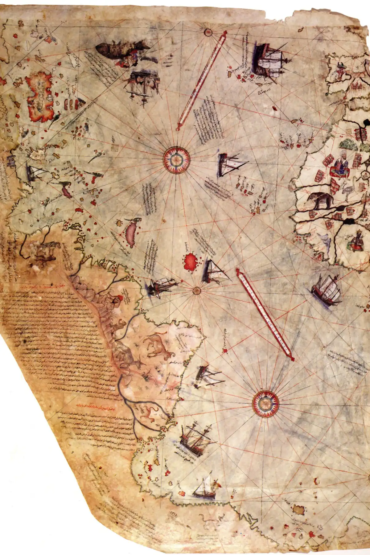
The Piri Reis Map and the Coast That Runs Off the Edge
In 1513 the Ottoman sea captain Piri Reis drew a chart of the Atlantic on gazelle skin, and along its bottom edge a coastline turns east and runs off the sheet. In the 1960s the historian Charles Hapgood read that coast as Antarctica drawn before the ice, and an Air Force squadron he wrote to called it reasonable. Map historians read it another way. This is what the map shows, what each reading rests on, and what is still unknown.