
In the Topkapi Palace in Istanbul there is a second world map by the Ottoman sea captain Piri Reis, drawn fifteen years after his famous chart of 1513. What survives of it is one corner: a sheet of parchment about seventy centimetres square, catalogued as Hazine 1824, signed at Gelibolu in the Islamic year 935, which began in 1528.
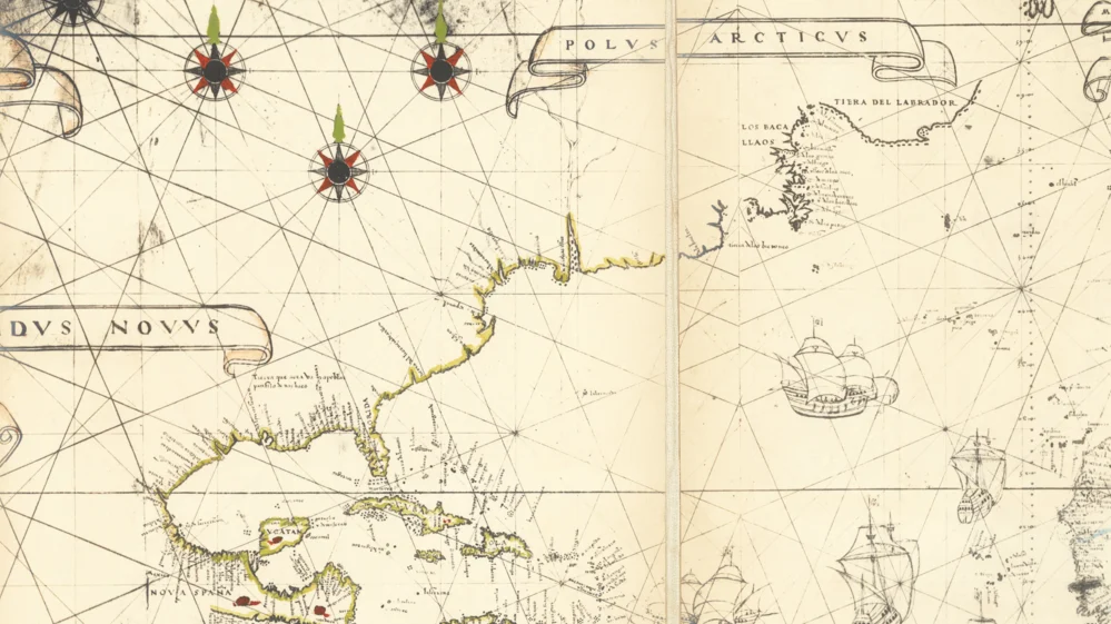
It is mostly sea. Pale parchment, crossed and recrossed by thin straight lines in red, green and black, the rhumb lines a pilot laid his course along. A painted border of flowers runs down the left side and along the top. Two scale bars hang in the upper left, wrapped in ribbons. Three ships sail across the open water. Low on the sheet, the islands of the Caribbean lie scattered in red and green, and in the lower left corner a coast curves away to the south.
Then the parchment stops, at a ragged lower edge.
Everything else that Piri Reis drew of the world in 1528 is gone.
The corner that survived
The historian of cartography Gregory C. McIntosh, author of The Piri Reis Map of 1513 (University of Georgia Press, 2000), published a detailed comparative study of the second map in 2015, in the journal Mediterranea - ricerche storiche. He describes it as "a parchment, about 70 cm high x 69 cm wide, and drawn and painted in black, blue, green, red, yellow, and other colors," and as the remnant of a larger world map: "The extant remnant is of the northwest corner of the map, the remainder being lost." It was, he writes, "probably completed in 1529 but known as the map of 1528."
The year comes from the map itself. West of Florida, in Arabic, Piri Reis signed it, in McIntosh's translation: "Drawn by the humble Piri Reis, son of Hajji Mehmet, known as the paternal nephew of the late Gazi Kemal Reis, in the city of Gelibolu in the year 935 [1528]. This is his work." Gelibolu is Gallipoli, the naval town on the Dardanelles where he was born. The rest of the writing on the sheet is in Ottoman Turkish, by a calligrapher.
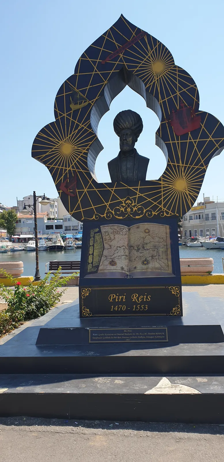
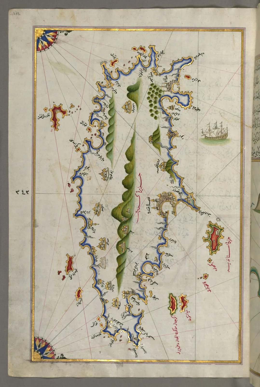
By then he had been at sea for decades. His first world map, of 1513, sits in the same palace library under another number, Revan 1633. Between the two he wrote the Kitab-i Bahriye, the Book of the Sea, a pilot's guide to every harbour and headland of the Mediterranean, finished in 1521 and enlarged in 1526. The Turkish encyclopedist Idris Bostan writes that in 935, 1528, he presented the second world map to Suleyman the Magnificent.
The corner appeared in print in 1937, in articles in the journal of the Turkish Historical Society, Belleten, listed in the bibliographies of the Turkish historian Afet Inan and of McIntosh. Inan put it into English in 1954 in The Oldest Map of America: "Fifteen years after this first map, Piri Reis drew a second one, again at Gelibolu."
What the sheet says
The writing on the surviving corner is short. McIntosh counts "eight inscriptions, two of which contain placenames," and 27 placenames, "but only 18 are legible." There are no lines of latitude or longitude, "except the Tropic of Cancer," with a note beside it: "This line indicates where the day is lengthened." The scale bars give the distances, "fifty miles each" from one division to the next.
The coasts run from Trinidad and the Gulf of Darien up through Central America, Yucatan, Cuba, Jamaica, Hispaniola, Puerto Rico and the Bahamas. Florida stands alone in the sea, "unattached to a mainland." Far to the north and east lie three lands that McIntosh reads as Newfoundland, Greenland and something between them. Beside one of them the calligrapher wrote: "This is an indication of another shore. The Portuguese infidels discovered it. All of it is unknown. Only the places known are sketched." Beside the middle land: "This is called Bakila. This too was discovered by the Portuguese infidels. Only what has been seen, however, has been written here." McIntosh reads Bakila as Bacallao, the Portuguese name for the cod coast of the far north.
A sheet that marks its own limits, line by line. All of it is unknown. Only what has been seen.
The question the corner raises is the one that has hung over Piri Reis since his first map came to light. Where did he get his information? The 1513 map carries notes on the charts he worked from. For the parchment of 1528, no note on the surviving corner names a single source.
The sea kings and the second map
The most famous answer to that question about Piri Reis is Charles Hapgood's. In Maps of the Ancient Sea Kings (Chilton Books, Philadelphia, 1966), Hapgood argued that the coast running along the bottom of the 1513 map was Antarctica, drawn before the ice, and that Piri Reis had copied it from source maps far older than any known voyage, made by a seafaring people of the Ice Age. The case is told in the first investigation of the map, with the 1960 letter in which a US Air Force reconnaissance squadron called that reading reasonable, and with the way historians read the same coast.
On Hapgood's reading, Piri Reis was a man holding fragments of a lost world and putting them together without knowing what they were. That is what gives his second map its weight. If he had such sources in 1513, he could have had them in 1528. Hapgood read Oronce Fine's world map of 1531 the same way.
Hapgood looked. He printed the surviving corner of 1528 as Figure 39 of his book, and wrote about its Cuba, which on the 1513 map is a stub of an island he took to be a relic of an older chart. "Here Piri Re'is represents Cuba in a form typical of the other maps of the day. He had evidently abandoned his ancient maps."
On Hapgood's own reading, then, the second map's Cuba marks a turn. In 1513 Piri Reis drew, among other things, a coast nobody else drew. Fifteen years later, on the surviving corner at least, he drew Cuba as the other maps of his day drew it.
Which leaves the part that did not survive. The surviving corner shows the northwest of the world. The coast that made the 1513 map famous runs along the far south. If the world map of 1528 reached that far, whatever Piri Reis drew there was on the part of the parchment that is gone.
If the sources were older
Set aside for a moment whether Hapgood was right about 1513. Ask the larger question. What would it mean if a map-maker in Gallipoli in 1528 held charts older than any voyage on record?
It would mean that an Ottoman captain was one of the few people alive holding the evidence, and that he knew it only as a set of old sheets. On that reading the two world maps would be windows onto the same lost archive, and the second one would show what he chose to keep from it after fifteen more years at sea.
It would mean the history of exploration had a chapter before its first chapter. The voyages of Columbus and the Corte-Reals would be rediscoveries of coasts somebody had charted long before, and our own account of how the shape of the world was learned would be missing its beginning.
It would mean our species had reached the open ocean, measured it and drawn it far earlier than the record of our ships allows, and that the knowledge then fell out of use, kept alive only in copies of copies until it reached a library in Istanbul.
And it would leave one question still in front of us. If the evidence was ever on the 1528 parchment, it was on the part of it that has not come down to us. The surviving corner cannot answer that. Only the rest of the map could.
Spanish charts of the 1520s
The standard reading of the second map is McIntosh's, and it rests on the shapes of its coasts. He compared each part of the corner with the surviving European charts of the 1520s and found the same designs. Florida drawn as an "indeterminate insular peninsula," as it was after Juan Ponce de Leon's voyage of 1513, appears on only five maps of the period, and McIntosh traces it to the Padron Real, the master chart the Spanish crown kept in Seville, by way of the copies made from it: the Turin planisphere of about 1523, the Freducci and Verrazano charts of about 1526, the map known as the Pseudo-da-Vinci, of about 1527, and Piri Reis.
The names date it closer. On the Florida coast is San Juan Bautista, a name given in 1521 by the Spanish captains Gordillo and Quejo to a river in what is now South Carolina; McIntosh calls it evidence of "a Spanish map made after 1521." Newfoundland keeps the older Portuguese outline of the Corte-Real voyages of 1501 and 1502. The land between Newfoundland and Greenland takes a shape found on the Kunstmann IV chart of about 1520, the Turin planisphere, the Salviati planisphere and Verrazano's map of 1529, and on "all the maps made by Diego Ribero between 1527 and 1535," the Portuguese cartographer who made maps for Spain. Even the inscriptions say the northern coasts came from "the Portuguese infidels."
His conclusion: "the sources used by Piri Reis in making his world map of 1528 were predominately Spanish maps (often made by Portuguese cartographers working in Spain), though we must recognize that some of this cartography may have come to him through the intermediation of Italian maps." On this account the second map is a feat of intelligence, not of memory: news of a river named in 1521 reached a chart-maker in Gallipoli within a few years.
What the comparison does not reach
The standard account matches designs. It points to a family of charts and to the Padron Real behind them. It does not put a single surviving sheet beside the corner and show that Piri Reis copied it.
No inscription on the surviving corner says where its coasts came from, and McIntosh does not claim to have found a single source map. His argument is that the shapes on the parchment belong to a family of charts, and the family is Spanish and Portuguese. It is a strong argument for the corner. It says nothing about the rest of the world map, because nobody can compare a coast that is not there.
Two of the specialists who have studied the corner read it differently in places. Inan, in 1954, saw Florida "drawn very much as we know it today"; McIntosh, in 2015, saw an "indeterminate insular peninsula." She counted "four wind-roses"; he counted three full roses and half of a fourth at the edge. Some of what is written there is still unread: nine of its 27 placenames are illegible, and McIntosh writes that "the significance of the name on Hispaniola is unknown." Even Bakila is a puzzle. It carries the name of Newfoundland's cod coast and the shape of a land further north, and McIntosh counts it among the "mysteries" of how the name Labrador moved across the maps of the century.
And the printed record has drifted. Several modern works give the map a "Terra Nova" that, McIntosh points out, is not on it.
The rest of the parchment has not been found. Nobody knows what was on it.
A corner in the treasury
The parchment is still in the Topkapi Palace, and it has been shown in public there, in the palace's exhibition of 2013 for the five hundredth anniversary of the first map. Among the studies of it are Inan's in 1954, the historian Svat Soucek's Piri Reis and Turkish Mapmaking after Columbus in 1996, and McIntosh's in 2015.
What it shows is a sea captain at work in the 1520s, collecting the newest charts of the Spanish and Portuguese, marking honestly what he had and had not seen, and drawing it for a sultan. That much the corner settles.
What it cannot settle sits beyond its ragged edge.
One corner of a world map. The northwest, the part of the world that Europe was charting fastest. If the map reached the far south, where the 1513 coast ran off its sheet, that part has not come down to us. If it survives anywhere, in a binding, a box or another library, it would show how Piri Reis drew the far south in 1528, fifteen years and many new charts after the first map. If it does not survive, the second map will go on doing what it does now: showing how carefully he worked, on the one corner where his sources can be traced.
Questions This Leaves You With
Is there anything a person actually does with this?
Not with your own life, honestly. A map of 1528 has no date in it for anything still to come, and anyone who tells you otherwise is selling something. The larger question is about how knowledge travels: how a river named by Spanish captains in 1521 could appear on a chart drawn in Gallipoli a few years later, and what else moved along the same routes that we have no record of. That question is open, and it is not yours alone to answer. What you can do is notice how much of any old map is copied, and ask from where.
Does this sit against a religious account of the world?
It can be read both ways, and serious people have read it both ways. Piri Reis signed his map as "the humble Piri Reis" and, by the Turkish encyclopedia's account, presented it to his sultan. Readers since have found in the idea of a lost seafaring age either a challenge to a short sacred history or an echo of the older ages that many traditions describe. This site will not tell you which way it falls for you. The parchment itself says nothing about God, only about coasts, ships and what had been seen.
Does this change what a human life is?
Hold your own life against the scale of this story: one man, born in a harbour town, who spent decades at sea and drew two maps of the whole known world, and both survive only in part. One way of seeing it makes a life smaller; almost everything he drew is lost. The other makes it larger; a corner of one sheet, five hundred years later, still carries his name, his town and his care about what he did not know. Which of those did you feel?
What would change your mind, in either direction?
Name it now, before you are committed, because it is harder later. Toward a lost older source: a chart securely dated, by its material and its history, to long before the voyages of the 1490s, carrying coasts with features that match surveyed ones one for one; or physical evidence of ocean-going people at the date Hapgood proposed. A southern coast on the lost part of the 1528 map, by itself, would show only that Piri Reis reused his own chart. Toward the standard account: a surviving Spanish or Portuguese chart of the 1520s that matches the corner line for line; or the source charts behind the 1513 map's southern coast turning up in an archive. Notice how much each list asks of a single sheet.
Where is the rest of the map?
This is the gap, and it is plain. A world map presented to a sultan was not a scrap. It was a large, painted, valuable object, and somewhere between the sixteenth century and the twentieth, all but one corner of it was cut away or lost. Nobody in the record says when, how or where the rest went. The 1513 map is itself a surviving piece of a larger sheet. Two world maps by the same man, and both survive only in part. Whether the missing pieces were destroyed, reused or are sitting unrecognised in a collection somewhere is a question no one has been able to answer.
Sources
- The Piri Reis Map of 1528: A Comparative Study with Other Maps of the Time, Mediterranea n. 34 (2015), pp. 303-318 Gregory C. McIntosh, Mediterranea - ricerche storiche Study
- Piri Reis, TDV Islam Ansiklopedisi vol. 34 (2007) Idris Bostan, Turkiye Diyanet Vakfi Study
- The Oldest Map of America, Drawn by Piri Reis (1954), pp. 42-48 Afet Inan, Turk Tarih Kurumu, Ankara Study
- Maps of the Ancient Sea Kings (1966; 1996 edition) Charles H. Hapgood, Chilton Books / Adventures Unlimited Press Primary record
- Topkapi Palace Museum features Piri Reis collection (2013) Hurriyet Daily News / Anatolia News Agency Study
- Piri Reis and Turkish Mapmaking after Columbus: The Khalili Portolan Atlas (1996), catalogue record Svat Soucek, Nour Foundation / Azimuth / Oxford University Press Study
- The Piri Reis Map of 1528: notice of McIntosh's study (2017) Medievalists.net General reference