
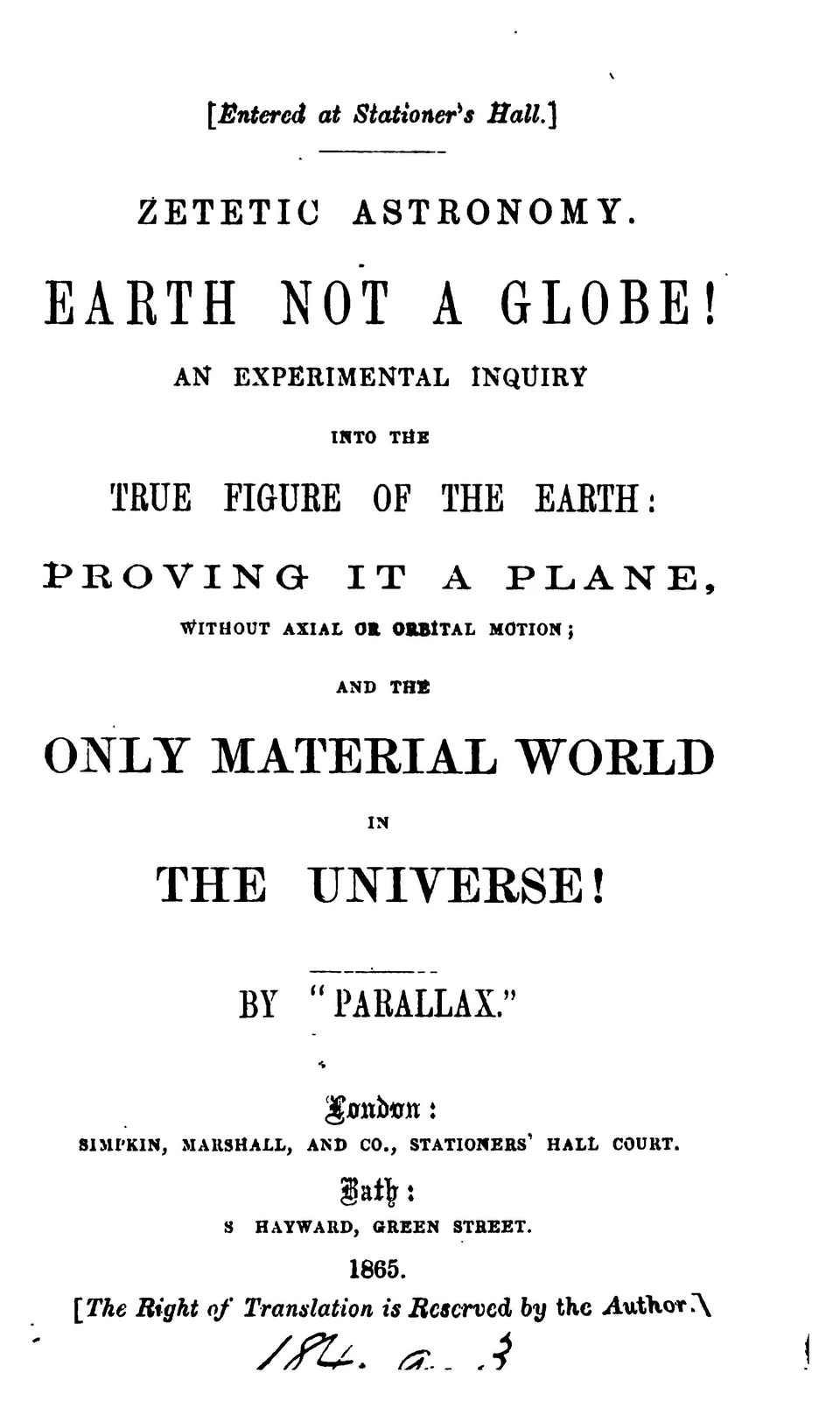
Zetetic Astronomy: Earth Not a Globe! is a book of 221 pages printed in Bath and sold in London in 1865, under the pen name "Parallax." Its author, Samuel Birley Rowbotham, argued that the Earth is a flat plane with the north at its centre and ice at its rim, and he rested the argument first of all on one stretch of water in the English fens: a straight drain called the Old Bedford, which he said ran for more than twenty miles without a lock.
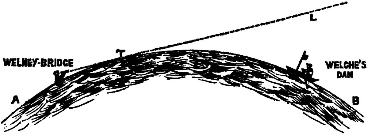
Six miles of it are at the heart of the case. Still water between two long banks. A boat with a flag on a staff, sailing away. And at the near end, seated in the water like a bather, a man with a telescope and his eye eight inches above the surface.
On a globe, the book says, the boat should sink below the line of the water as it goes. By the sixth mile the flag should be thirteen feet down, hidden behind a swell of water nobody can see.
The flag stayed in sight.
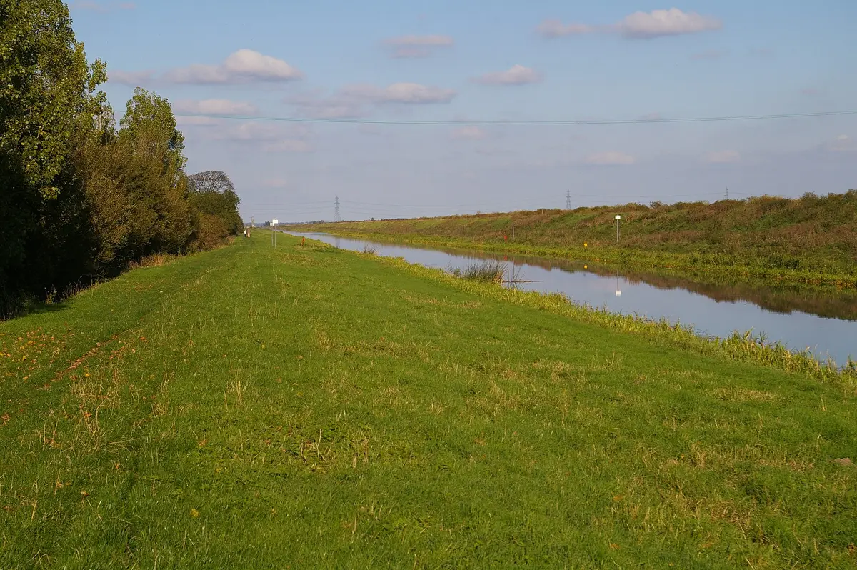
A bather in the Old Bedford
The 1865 book sets it out on its eleventh page, in the plain voice of a report. "A boat with a flag standing three feet above the water, was directed to sail from a place called "Welney Bridge," to another place called "Welche's Dam." These two points are six statute miles apart. The observer, with a good telescope, was seated in the water as a bather (it being the summer season), with the eye not exceeding eight inches above the surface. The flag and the boat down to the water's edge were clearly visible throughout the whole distance!"
The man behind the pen name had been on the road with it for years. The mathematician Augustus De Morgan, who collected such cases in his Budget of Paradoxes, traced the lecturer to Trowbridge in 1849, where "he was S. Goulden," and to Burnley that December, where two Lancashire papers reported that he left before his second lecture after being pressed to explain why a ship's hull disappears before its sails. Rowbotham himself later reprinted a notice from the Wilts Independent of 18 January 1849, describing two evening lectures at the Trowbridge Mechanics' Institution "by a gentleman adopting the name of 'Parallax.'" By October 1864 De Morgan heard of him lecturing in Plymouth. A year later the book arrived.
De Morgan read it in August 1865 and wrote that "if it be childish, it is clever; if it be mannish, it is unusually foolish." He also wrote something rarer for a critic. The author, he said, "neither impeaches the honesty of those whose opinions he assails," and in that he was "worthy to live on a globe, and to revolve in twenty-four hours."
The book did not stay at 221 pages. The edition of 1881 runs to 430, and carries a preface "to the Second Edition" dated London, 24 September 1872.
Parallax's proof
The case begins with arithmetic. On a globe the size of the Earth, Rowbotham wrote, the surface of water falls away from a level line by "8 inches in one mile, and in every succeeding mile 8 inches multiplied by the square of the distance." With the eye eight inches above the water, his figures put the boat at the far end "200 inches or above 16 feet below the surface of the water" at the observer, and the flag, three feet tall, "13 feet below the line-of-sight."
He chose his ground with care. Not the sea, with its tides and swell, but a canal: "nearly stationery--often entirely so, and throughout its entire length has no interruption from locks or water-gates." Not a theory, but a test anybody could repeat. That was the point of the strange word on the cover. "The term "zetetic" is derived from the Greek verb zeteo; which means to search or examine--to proceed only by inquiry." Look first. Believe what is seen. Let the astronomers' figures wait.

And the conclusion followed in capitals. "From this experiment it follows that the surface of standing water is not convex, and therefore that the Earth IS NOT A GLOBE!"
The rest of the shape came from that one fact. If the water is flat, the world is a plane, and the book drew it: a round map with the north pole at the centre and the continents laid out around it, "ONE CENTRE--THE NORTH, and ONE CIRCUMFERENCE--THE SOUTH," both "icy or frozen regions." The south, on this reading, is not a pole at all but a ring of ice running round the edge of everything. By 1881 the ring had become "vast and lofty cliffs of ice," and the map had grown a central sea "surrounded by a great wall or barrier of ice, eighty to a hundred miles in breadth."
Later flat-earth maps drew the world the same way, with the north at the centre, the Gleason map of 1892 among them, and a ring of ice at the rim is still part of the argument about the Antarctic Treaty.
Rowbotham did not leave it at one afternoon. In the 1881 account the boat set off at about three in the afternoon of a summer's day, "the sun was shining brightly and nearly behind or against the boat," and the flag on its staff stood five feet high. The same edition says the observations were "first made by the author in the summer of 1838," then repeated "in 1844, in 1849, in 1856, and in 1862," and that he went back to the canal on Tuesday, 5 April 1870, leaving London for Downham Market. By then the experiment had followers. Earlier that spring the flat-earth writer John Hampden of Swindon had staked 500 pounds on a new trial on the same canal, and the naturalist Alfred Russel Wallace had taken the bet.
He also told of the one sighting that seemed to go the other way. A gentleman had the telescope turned on a barge sailing in the opposite direction, and "it suddenly disappeared altogether!" Rowbotham's answer came from the ground: a local wildfowler pointed to a bend in the canal on that stretch, and a map, he wrote, "fully verified" it.
If the water is flat
Set aside for a moment whether the flag really stayed in sight. Ask the larger question. What would it mean if a level line across six miles of water held?
It would mean the oldest measurement in astronomy was wrong at its root. Eratosthenes measured shadows in Egypt in the third century BC and took a globe for granted; every sailor's chart and every surveyor's table after him did the same. On Rowbotham's reading all of it rests on a curve that a man in a canal could not find with his own eye.
It would mean the shape of the world had been decided by authority rather than by looking. The book's whole argument is that nobody had done the simple thing. If he was right, the question would no longer be about water. It would be about how much else we hold because it was taught, not because it was seen.
It would mean our maps are fictions drawn to fit a theory. The south would not be a continent at the bottom of a sphere but a frontier of ice at the edge of a disc, and the long voyages around it would be voyages along a wall.
And it would leave the largest question in front of us. A plane with a frozen rim has an outside. Rowbotham's own key to his 1881 map ends there, at "the outer gloom and darkness, in which the material world is lost to human perception." If the water is flat, nobody has yet been to the edge and come back to say what is past it.
The bending of light
The standard account answers with the air.
Light does not always travel straight through air. Where the air close to a cool surface is colder and denser than the air above it, a ray grazing that surface is bent downward, following the water. The atmospheric optics specialist Andrew T. Young of San Diego State University puts the threshold in one line: "a temperature inversion of about 0.11 deg/m will make the ray curvature match that of the Earth." When that happens the ray hugs the curve, and a boat that should be hidden stays in view. Young quotes the physicist J. D. Everett, writing in 1874: "The visible effect is precisely the same as if the convexity of the surface of the earth were diminished."
An eye eight inches above cool water sits in the air layer that matters most, the one in contact with the surface. The surveyors' rule Rowbotham himself quoted already made an allowance for the bending, that refraction "may at a mean compensate for about a seventh of the curvature of the earth," while it "sometimes exceeds a fifth, and at other times does not amount to a fifteenth," and then sets it aside: "We have, therefore, made no allowance for refraction in the foregone formulae."
On this account, a fair test lifts the line of sight well clear of the water and puts marks of equal height along the canal, so that a curve shows as a middle mark standing higher than the two ends. That is what Wallace set up in 1870, and the arguments over his result are a story of their own.
What the counter does not reach
Refraction explains how a boat could stay in sight. It does not say that it did, or how much it bent on that afternoon.
Nobody recorded the temperature of the air or the water. Without them the bending cannot be worked out after the fact, in either direction. The canal on Rowbotham's days could have been an inversion that hid the curve, or an ordinary afternoon. The record does not say.
The record does say other things, and they come from Rowbotham himself. His two printed accounts differ in their details, which may mean two different trials, or one remembered twice. In 1865 the flag is three feet high, the boat sails from Welney Bridge to Welche's Dam, and "the observer" sits in the water. In 1881 the flag is five feet, the boat sails the other way, and "the author" goes in. The year, "the summer of 1838," appears in the 1881 book, 43 years after the date it gives; the 1865 account gives none.
No measurement of the air on any of those days survives. Nobody has them.
Still water
The book outlived its author by more than a century. Rowbotham died in 1884. The Zetetic movement he started went on without him, and in 1904 or 1905, by the account of the mathematical historian David Singmaster, the flat-earth writer Lady Elizabeth Blount led her own expedition to the Old Bedford, to answer Wallace. The canal kept drawing people who wanted to see for themselves.
That is the part of Zetetic Astronomy that has never gone away. Not the map, which is a drawing, and not the ice wall, which is an inference. The method. A claim that anyone with a telescope and a long straight piece of water can check the shape of the world.
The water is still there, six miles of it, running dead straight between its banks past Welney.
What was never taken on Rowbotham's afternoons is the reading that would have settled them: a thermometer at the water and another a few feet above it. Those afternoons cannot be measured now. The canal can still be, on any summer day, by anyone who brings two thermometers, a telescope and a flag, and writes down all three.
Questions This Leaves You With
Is there anything a person actually does with this?
Honestly, very little follows for your own life. The shape of the Earth does not change your rent, your health or your next ten years, and anyone who sells you urgency about it is selling something. The larger question is not personal. It is how a society decides what it knows: by authority, by measurement, or by both, and what happens when the two seem to disagree. That one is genuinely open, and it is bigger than any canal. What you can do is notice how often a claim you hold rests on a test you have never seen run.
Does this sit against a religious account of the world?
It can be read both ways, and serious people have read it both ways. Some flat-earth writers of the nineteenth century tied the plane to a literal reading of scripture; many religious readers of the same century saw no conflict between their faith and a globe, and said so. This site will not tell you which way it falls for you. The book itself rests its case on a canal and a telescope, not on a text, and that is worth holding on to whatever you believe.
Does this change what a human life is?
Put your own life against the scale in the middle of this story: a single man, sitting in a fen drain, setting his eye against the shape of the whole world. One way of reading it makes a life smaller, one stubborn figure against centuries of measurement. The other makes it larger: a person who refused to take anything on trust and went to look. Which of those did you feel when you read it?
What would change your mind, in either direction?
Name it now, before you are committed, because it is harder later. Toward Rowbotham: the same test run with thermometers at the water and above it, showing no inversion, and the flag still in view at six miles; or marks of equal height that line up straight. Toward the globe: the same marks, set well above the water, with the middle one standing high; or a camera that loses the boat's hull from the bottom up as the air is measured. Notice that both lists ask for the same thing, a measurement of the air.
When did 1838 enter the story?
This is a gap in the record of the book itself. The 1865 edition tells the canal test with no year. The 1881 edition dates it to the summer of 1838. In between came the edition with the preface of 1872, and no copy of it has been found online to show whether the date was already there. The 1849 pamphlet, the first printing of the argument, has not been located at all. Somewhere in those missing pages is the moment an undated afternoon became the founding date of a movement, and nobody can yet point to it.
Sources
- Zetetic Astronomy. Earth Not a Globe! (1865) Parallax [Samuel Birley Rowbotham], London: Simpkin, Marshall; Bath: S. Hayward; Project Gutenberg Primary record
- Zetetic Astronomy (1865), page images of the Bodleian copy Internet Archive Primary record
- Zetetic Astronomy: Earth Not a Globe (third edition, 1881) Parallax [S. B. Rowbotham], transcription at sacred-texts.com Primary record
- A Budget of Paradoxes, vol. II (2nd ed. 1915), 'Zetetic Astronomy', pp. 88-92 Augustus De Morgan, ed. D. E. Smith; Project Gutenberg Primary record
- Looming, Towering, Stooping, and Sinking Andrew T. Young, San Diego State University Study
- Welney, Norfolk, Mathematical Gazetteer of the British Isles David Singmaster, MacTutor, University of St Andrews Study
- Rowbotham, Samuel Birley (Parallax) (1816-1884), person record Alfred Russel Wallace Correspondence Project, Epsilon Study