
The Vinland Map is a world map drawn in ink on a sheet of parchment, kept at Yale University's Beinecke Rare Book and Manuscript Library. When Yale revealed it in October 1965 it was presented as a copy, made around 1440, of a map showing the coast of North America half a century before Columbus. In September 2021 Yale announced that its ink is full of a titanium pigment first made in the 1920s.
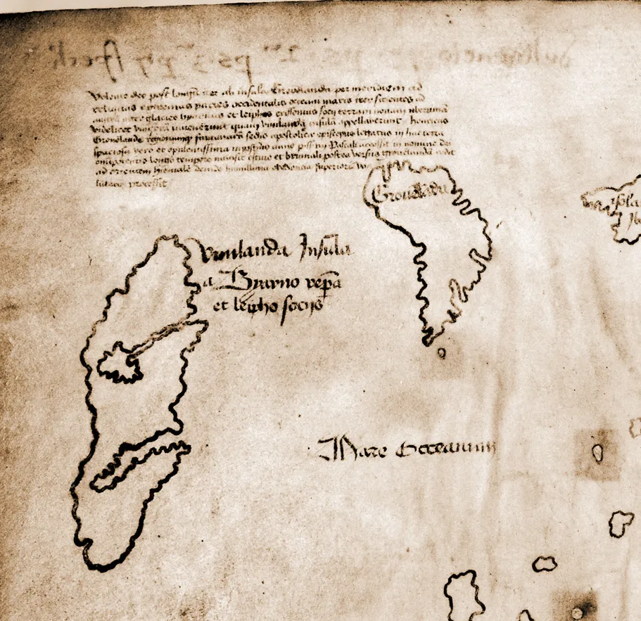
It is about the size of a placemat. Faint brown lines on pale skin, folded down the middle. Europe, Africa and Asia take most of the sheet. At the top left, out in the western ocean past Iceland and Greenland, is an island with two deep inlets cut into its side.
Across it, in a careful hand: Vinlanda Insula.
The island of Vinland, discovered, the legend says, by Bjarni and Leif.
A parchment from a bookshop
The map came out of the book trade. Its story, in the account of the PBS documentary The Viking Deception, "began in 1957 when two book dealers, including an Italian named Enzo Ferrajoli," brought it onto the market, bound with a medieval manuscript called the Tartar Relation. The American dealer Laurence Witten was the one "who bought the map and the accompanying manuscript for $3,500." The Beinecke's catalogue says only that he acquired it "from a private collection in Europe." The binding was modern, and the map's place in it made little sense.
Then the pieces came together. Witten found that another manuscript, then owned by the Yale librarian Thomas Marston, a volume of the medieval encyclopedia called the Speculum Historiale, had once been bound with the map and the Tartar Relation. The proof was in the wormholes. Holes eaten through the pages, the Beinecke's catalogue records, match in a single order: map, Speculum, Relation, once "bound together in this order in a single volume."
The Yale alumnus Paul Mellon then bought the map and the manuscripts, NOVA says, and gave them to the university; the catalogue names only "an anonymous donor." Mellon had the map kept secret "while a scholarly volume was prepared." On 11 October 1965, the day between Leif Erikson Day and Columbus Day, Yale announced the map and published The Vinland Map and the Tartar Relation by R. A. Skelton, Thomas Marston and George Painter. Its authors judged the map "the earliest known representation of any part of the New World," made in northern Europe in the fifteenth century. American Heritage, that month, traced it "to a copyist in Basel about 1440."
The long legend above the island tells the story in Latin. In the translation American Heritage printed that month: "By God's will, after a long voyage from the island of Greenland to the south toward the most distant remaining parts of the western ocean sea, sailing southward amidst the ice, the companions Bjarni and Leif Eiriksson discovered a new land, extremely fertile and even having vines, the which island they named Vinland."
The case for a medieval map
The case for the map was strong, and serious people made it.
The parchment is old. In 2002 a radiocarbon study by Douglas Donahue, Jacqueline Olin and Garman Harbottle dated the skin to "AD 1434 plus or minus 11 years," exactly when the 1965 authors had placed it. The wormholes tie the map to two genuine medieval manuscripts. The map shows Greenland as an island, and the Norse voyages to the west are real.
The ink was argued over for decades. In 1974 Walter McCrone's laboratory reported titanium in the ink, in the form of anatase, a white pigment made commercially only from the 1920s. But in 1985 Thomas Cahill and colleagues at the University of California, Davis, using a particle beam, found titanium "only in trace amounts," the Beinecke catalogue records, which "suggests the previous quantitative analysis was not methodologically sound." Jacqueline Olin argued that anatase could form naturally in a medieval ink.
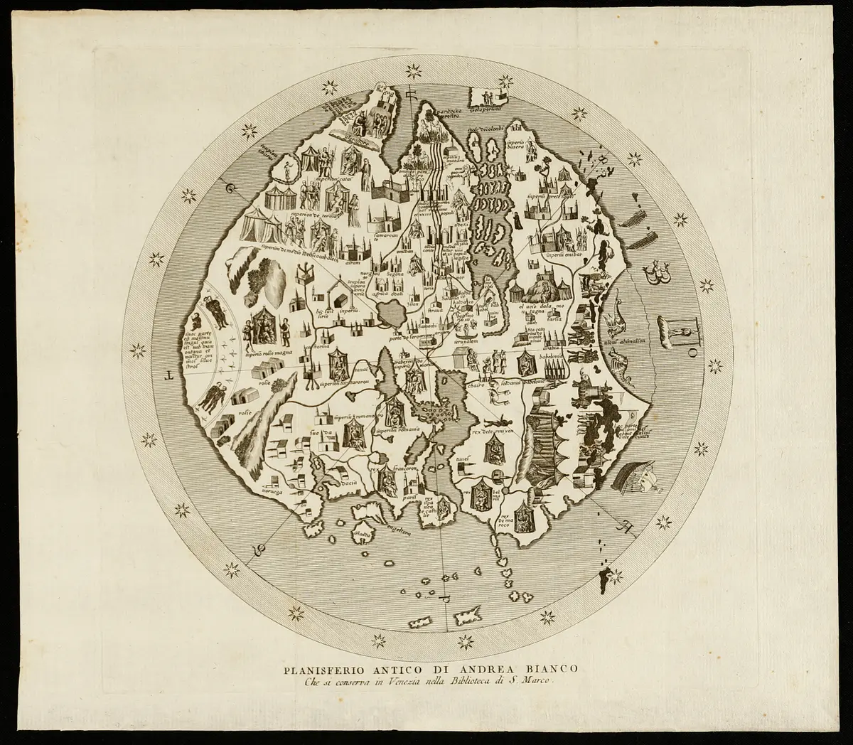
And in July 2009, at a conference in Copenhagen, Rene Larsen of the Royal Danish Academy of Fine Arts said his team's tests over the past five years "do not show any signs of forgery." The anatase, he suggested, "probably came from sand used to dry wet ink." Sand would leave grains here and there; it would not explain titanium running through every line, which is what Yale later reported.
On that reading, a monastery copyist in the 1440s drew a world map with Vinland on it, and the Norse knowledge of America survived in Europe's libraries until Columbus sailed.
If the map was real
Set aside for a moment whether it was. Ask the larger question. What would it mean if a map of the 1440s showed Vinland?
It would mean Europe knew there was land across the western ocean before Columbus set out, and wrote it down. The story of 1492 as a leap into the unknown would become the story of a rediscovery.
It would mean the Norse voyages lived on in scholarship, not only in sagas told in Iceland, and that a copyist in Basel could have learned of a land west of Greenland from books he had in front of him.
It would mean our picture of how knowledge travelled in the Middle Ages is too small. Information we assume was lost for centuries would have been passed from Greenland to the libraries of Europe and copied onto parchment.
And it would leave a question still in front of us: what other maps of that kind might still lie bound into the back of an old book, unrecognised.
Titanium in the lines
The standard account is now Yale's own. Conservators and scientists at the Beinecke and Yale's Technical Studies Laboratory scanned the whole map. They announced the result on 1 September 2021. "The analysis revealed that a titanium compound used in inks first produced in the 1920s pervades the map's lines and text," YaleNews reported.
The scan of Vinlanda Insula itself "revealed high levels of titanium and smaller amounts of barium." The anatase particles, the conservation scientist Richard Hark said, closely resemble a pigment produced in Norway in 1923. The team compared the ink with fifty genuine fifteenth-century fragments of Central European manuscripts in the Beinecke's collection: they had "far lower levels of titanium than the map and much higher levels of iron."
And they found an inscription on the back of the map, written in old iron-gall ink, meaning roughly "second part of the third part of the Speculum," a binder's note. It had been overwritten in titanium ink, Yale reported, to read roughly "drawing first-part, second-part of the third part of the Speculum," as if the map belonged at the front of the volume. "I think that constitutes pretty strong evidence of a motive to deceive," Hark said.
"The Vinland Map is a fake," said Raymond Clemens, the Beinecke's curator of early books and manuscripts. "There is no reasonable doubt here."
What the ink does not tell
The ink dates the pigment, and so the earliest the lines could have been drawn. It does not answer who drew them, or why.
The parchment is genuinely old. The radiocarbon date and the wormholes still stand, and Yale's own radiocarbon dating of the Speculum and the Tartar Relation, in 2018, put them at about 1400 to 1460. The forger, on Yale's account, drew on a real blank leaf from the front of a real medieval book. "It doesn't tell us who perpetrated the deception," Clemens said.
Who did is still argued. The historian Kirsten Seaver, in Maps, Myths, and Men (Stanford University Press, 2004), named a Jesuit scholar of early maps, Josef Fischer, who died in 1944. Others have pointed elsewhere, and nobody has proved a name. The map's whereabouts between the drawing and 1957 are unknown.
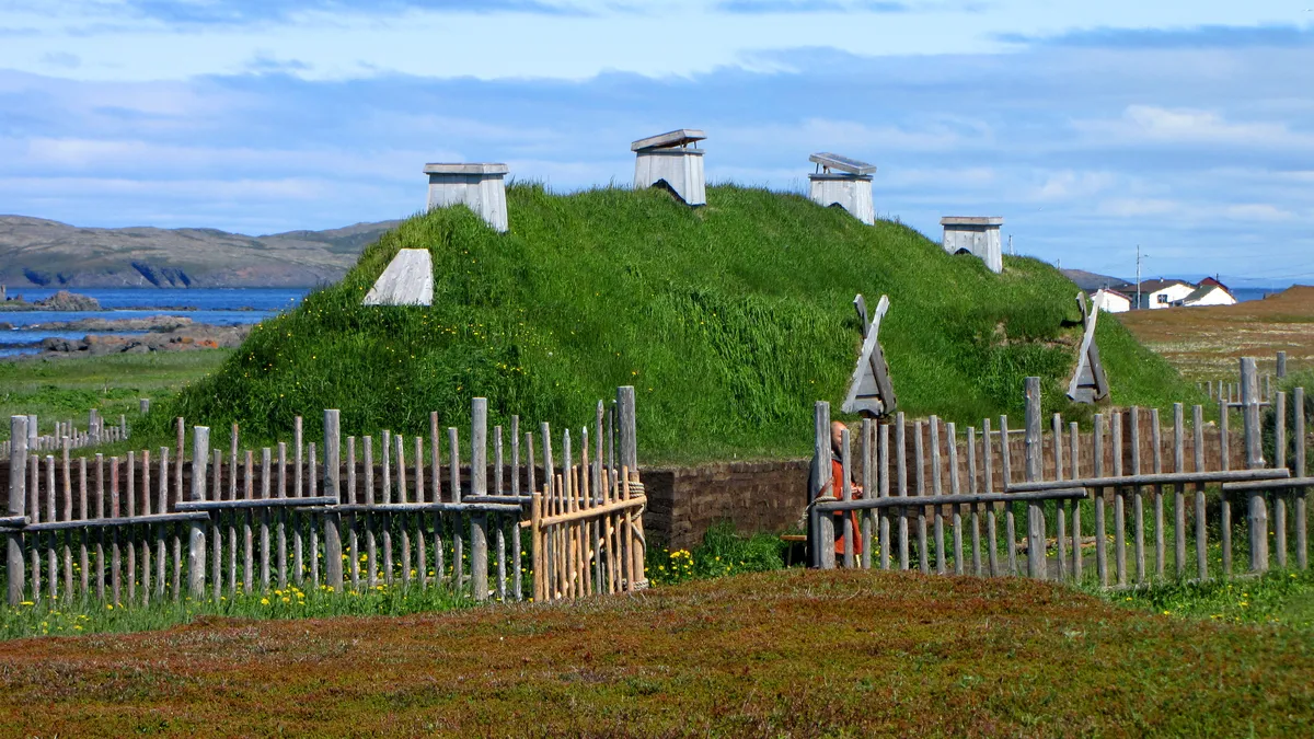
And the Norse in America are real, map or no map. In 1960 Helge and Anne Stine Ingstad found the remains of eight Norse buildings at L'Anse aux Meadows in Newfoundland. In 2021 Margot Kuitems and colleagues used a burst of cosmic radiation recorded in tree rings to date wood cut there: "the Vikings were present in Newfoundland in AD 1021."
No genuine medieval map of Vinland has been found. Other old charts of the North Atlantic carry arguments of their own, from the islands of the Zeno chart of 1558 to the Newfoundland of Piri Reis's map of 1528, drawn from Portuguese reports.
A placemat at Yale
The map is still at the Beinecke, catalogued as MS 350A, now described by its own curator as a forgery and kept, he said, because "the map has become an historical object in and of itself." It went on show at the Mystic Seaport Museum in 2018, and it is still bound up with the genuine manuscripts it was made to join.
What it proves is something smaller and stranger than its legend. Someone in the twentieth century took a blank leaf from a real fifteenth-century book, drew the world on it in a medieval hand with a modern pigment, altered a binder's note to make it belong, and let it go into the trade. For more than fifty years it fooled some of the best map historians in the world, and its parchment still passes the radiocarbon test.
The Norse reached America around the year 1000, and they were there in 1021. The map that was taken to show that Europe remembered them was drawn, the ink says, after the 1920s. Whether any real fifteenth-century map remembered Vinland is a question the Vinland Map can no longer answer.
Questions This Leaves You With
Is there anything a person actually does with this?
Not with your own life, honestly. The map changes nothing about your next ten years, and anyone who sells you urgency about it is selling something. The larger question is how we test old documents: which test can be trusted, and why one laboratory found titanium everywhere and another found almost none. That question is open in every archive in the world. What you can do is notice, when a document is offered as proof, whether anyone has tested the ink as well as the paper.
Does this sit against a religious account of the world?
It can be read both ways, and serious people have read it both ways. The map's legend tells of a bishop of Greenland who went to Vinland in the name of God, and some readers find in it a picture of a church that kept the knowledge of the western lands. Others see nothing in the story of a forged map that touches their faith. This site will not tell you which way it falls for you. The map's ink is a matter of chemistry, not belief.
Does this change what a human life is?
Hold your own life against the scale in this story: a parchment six hundred years old, a forger's ink a hundred years old, and a Norse house in Newfoundland a thousand years old. One way of seeing it makes a life smaller; one unknown person fooled the experts for half a century. The other makes it larger; people kept testing it until the ink gave up its date. Which did you feel?
What would change your mind, in either direction?
Name it now, before you are committed, because it is harder later. Toward a medieval map: a published, peer-reviewed study showing the titanium is natural to a fifteenth-century ink, measured across the whole map, with the altered inscription explained. Toward the standard account: Yale's full results published in a peer-reviewed journal (in its September 2021 announcement the team said it planned to publish them in scholarly articles), and a firm line of ownership showing where the book was before 1957. Notice that both lists ask Yale's team for the same thing, the full data in print.
Who drew it?
This is the real gap. Yale's scientists can date the ink and show that someone altered an inscription to make the map look as if it belonged in the book. They cannot name the person. Seaver's candidate died in 1944; others have been proposed; none has been proved by handwriting, letters or a paper trail. At some point after the 1920s, and before the map surfaced in 1957, a skilled person sat down with a blank medieval leaf and a modern ink. Their name, and their reason, are still missing.
Sources
- Analysis unlocks secret of the Vinland Map: it's a fake (1 September 2021) Mike Cummings, YaleNews Primary record
- Beinecke MS 350A, Medieval and Renaissance Manuscripts catalogue Beinecke Rare Book and Manuscript Library, Yale University Primary record
- The Viking Deception, NOVA (2005) PBS / WGBH Study
- 50 Years After the Firestorm (2018) Mystic Seaport Museum Study
- The New World on the Map, American Heritage, October 1965 American Heritage Primary record
- Determination of the Radiocarbon Age of Parchment of the Vinland Map, Radiocarbon 44 (2002) D. J. Donahue, J. S. Olin, G. Harbottle Study
- The Piri Reis Map of 1528: A Comparative Study with Other Maps of the Time, Mediterranea n. 34 (2015) Gregory C. McIntosh Study
- Earliest map of America no forgery, expert says (17 July 2009) Reuters, The Globe and Mail Study
- Maps, Myths, and Men: The Story of the Vinland Map (Stanford, 2004), review Publishers Weekly Study
- Culture and history, L'Anse aux Meadows National Historic Site Parks Canada Primary record
- Evidence for European presence in the Americas in AD 1021, Nature 601 (2022) M. Kuitems et al. Study