
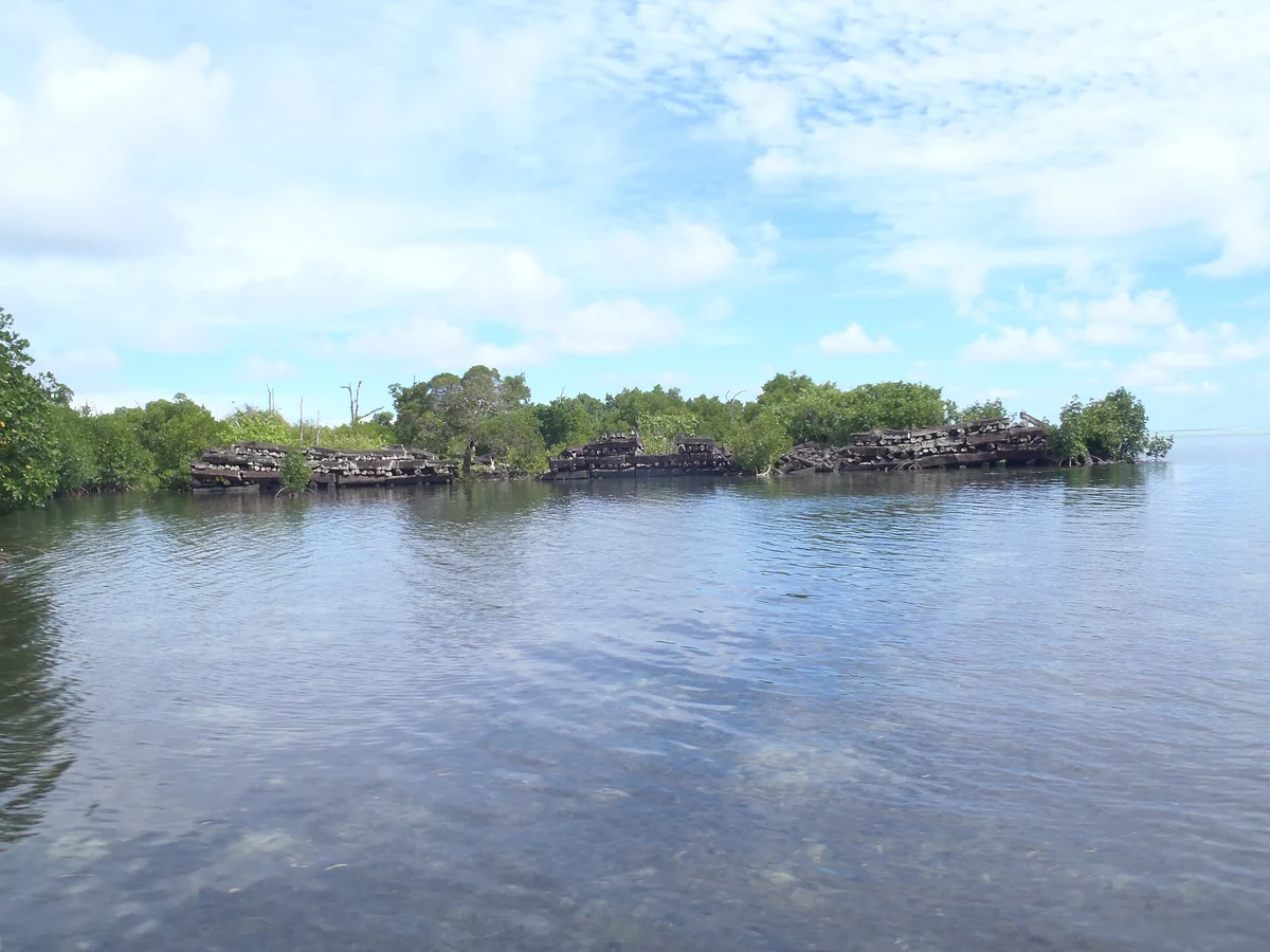
Nan Madol is a city of black stone on the reef flat off the south-eastern shore of Temwen Island, beside Pohnpei in the Federated States of Micronesia. About a hundred artificial islets lie there among canals, walled and raised with columns of basalt, and the exact count depends on who is counting.
Laid lengthwise they run along a wall like felled timber. Between those courses others sit end on, so that the face of the wall is a stack of long grey logs and rows of five-sided and six-sided butts, each one a prism shaped by cooling lava. At the corners the courses swing upward. At Nan Dauwas, the great enclosure of tombs, the outer wall stands about eight metres high in places, over a core of coral rubble.
Beyond it the sea wall of Nan Mwoluhsei runs some 275 metres along the edge of the deep water.
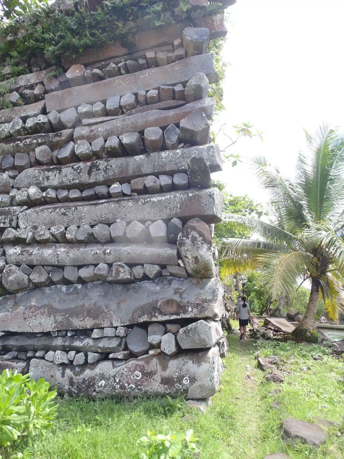
No source of columnar basalt lies close to Nan Madol.
The City That Was Never Lost
Nan Madol was never lost. It has been in Pohnpeian history the whole time.
In the account David Hanlon set down in Upon a Stone Altar (1988), drawn from Pohnpeian oral tradition, two wise and holy men, Ohlosihpa and Ohlosohpa, came by canoe from Katau Peidi in the west, bringing a sacred ceremony. At the reef called Sounahleng, with the help of gods and men, they began the islets. Ohlosohpa became the first Saudeleur, the Master of Deleur. Priests offered a turtle to Nahn Samwohl, the great saltwater eel on the islet of Idehd. The rule ended when Isohkelekel, son of the thunder god Nahn Sapwe, arrived with 333 companions. Official X worked from Hanlon and did not read Luelen Bernart's Book of Luelen itself. As for the stones, the Pohnpeian archaeologist Rufino Mauricio said in 2010 that people hold to the version in which the brothers used magical powers to fly the logs in. The story, Mauricio added, indicates that the logs probably came from far away.
Johann Kubary published on the ruins in 1874. F. W. Christian visited three times in March 1895, measuring walls and digging until the Nahnmwarki of Madolenihmw ordered the work stopped. Paul Hambruch mapped the site in 1910 and numbered it from 1 to 130. The first full GPS survey, by Mark McCoy and colleagues in 2012, recorded 98 islet polygons and 12 breakwater walls.
On the lagoon floor he kept seeing broken pieces and whole pillars of basalt, and each time he asked his boatman what had brought them there. When a bit of black stone falls into salt water, the boatman said, it grows.
A Capital of Mu, a City Under the Sea
William Ayres estimated between 500,000 and 750,000 metric tons of building material. Joyce Bath and J. Stephen Athens gave the columns an average of 1 to 5 tons and wrote of boulders of up to 50 tons in the sea wall behind Nan Dauwas. Fifty tons is the weight of more than six hundred grown men, on an island of 337 square kilometres.
Kubary, comparing skulls, decided the architects had been a distinct black race, and Christian agreed. Forty-four years after Ignatius Donnelly sank a continent in the Atlantic, James Churchward sank one in the Pacific: The Lost Continent of Mu (1926) calls the ruin on "Panape" the most important in the South Sea Islands and one of the Seven Sacred Cities of the Motherland, on the authority of tablets only Churchward reported.
Later writers trace a story of Japanese divers and platinum coffins to Herbert Rittlinger's Der masslose Ozean, which the German National Library lists as a novel of 1954. Erich von Daniken repeated it, the critic Jason Colavito reports.
The strongest form of the case is under the water, and it has Pohnpeian roots. Tradition places a city of the gods, Kahnihmweiso, below Nahkapw Harbor. In 1978 divers working with Arthur Saxe reported coral-covered pillars some 6 metres tall at depths of over 25 metres. Graham Hancock's gallery of Ponape photographs says the temples "seem to be built over some kind of substructure now deep beneath the waves", and describes a forest of columns at up to 40 metres. In Ancient Apocalypse (2022), as ABC News reported it, Hancock's lost civilisation built the place more than 20,000 years ago.
If the Stones Are Older Than the People
Set aside for a moment whether it is true. What would it mean if it were?
For Nan Madol it would mean that the walls in the photographs are the top of something. The logs at the tide line would be a late floor on an older city.
For the Pacific it would mean stone builders on this shore some seventeen thousand years before the earliest settlement archaeologists give for Pohnpei.
For our own species it would move the floor under what we think people could do. We have told the story of cities as something that begins after the ice. On this reading we built in stone first, in the last Ice Age, and then forgot. We would have mislaid a whole chapter of ourselves.
It would carry a cost as well. It would mean that the people of Pohnpei are wrong about the central event of their own past, and that the names in their history belong to strangers.
And one consequence is still in front of us. If a drowned shore can hold a city, how much of what we count as the beginning sits on coasts now under water, where almost nobody has looked?
If no lost builders are needed, the frame reverses. Then the walls are what one island's whole political order left behind, and that may be the stranger thought of the two.
The Coral in the Walls
The standard account rests on three things. The first is coral. Uranium-thorium dating gives the time the coral packed into the walls died. McCoy and colleagues (2016) put the wall around the central vault of Nan Dauwas at AD 1172 to 1186. Chuan-Chou Shen's team, with McCoy, then dated 171 corals from 18 islets (2024): a first building phase of about AD 930 to 1130, a second from about 1170, and a stop in the early 1400s.
The second is the stone. The prisms are natural and needed no cutting; Christian saw no tool marks in 1895. McCoy and Athens (2012) sampled 30 columns of the commonest group: an average of 2.5 metres long and a mean of 0.8 tonnes, the weight of about eleven people. Bath and Athens's 50 tons belong to boulders, and Ayres's figure is all building material.
The third is the water. In February 2013 Tomo Ishimura's team ran sonar across Nahkapw Harbor and sent down divers. The bottom lay flat at 40 to 50 metres, with no tunnels. The columns at 20 to 30 metres were encased in coral, and the team obtained no evidence that they were built. The Oregon divers of 1988 and 1989 had raised one smaller column and found it coral throughout. Juliet Sefton and colleagues (2022) found that Pohnpei has been sinking and that relative sea level stood about 0.94 metres lower when Nan Madol was built: a metre, not an Ice Age shoreline.
Hanlon showed in 1990 that the lost-builder idea began among outsiders with their own reasons for doubting islanders. Pohnpeians today trace their descent to the builders.
The Quarry Nobody Has Matched
The coral says when. It does not say how, and here is the strange part.
McCoy's 2016 paper is plain: "archaeologists have yet to match architectural stone to a specific location where it was quarried." At the possible sources some columns were likely already lying loose, and anyone who pried others free left no clear trace.
They did not find it.
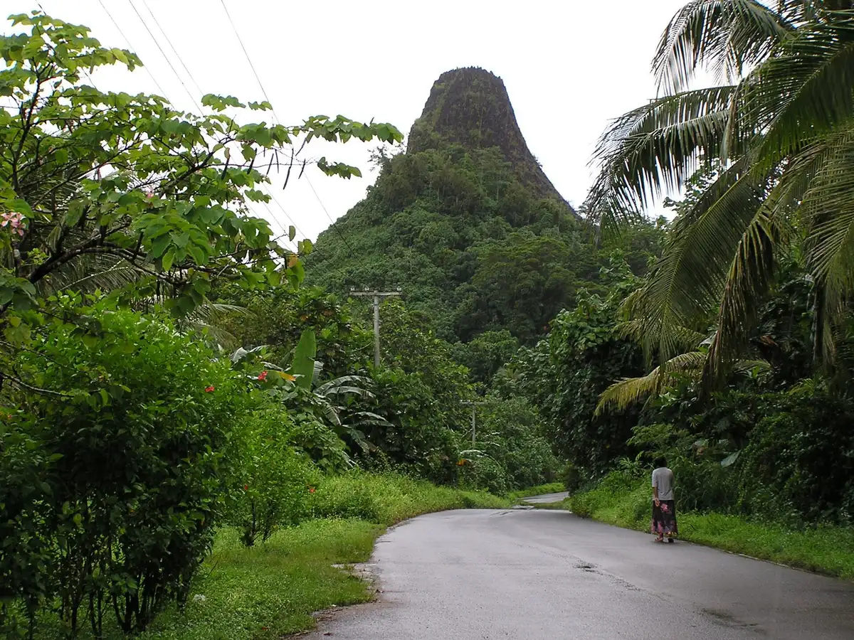
What they found is a direction. McCoy's team read 221 stones by portable X-ray fluorescence. Forty carried a chemical signature that likely came from one volcanic plug, Pwisehn Malek, on the opposite side of the island. In the wall and vault of the central tomb, the estimate is 40 percent. That plug, the authors write, had the highest transport cost of any potential quarry, and they read its use as the Saudeleur showing power over the whole island. Which means the tomb may carry a message in its route, and the route is on no map.
Kubary reported that the blocks were rafted down from the Not district on the north coast, and Christian wrote that this "tallies exactly" with what Nanchau of Mutok and the Au of Marau told him. Hambruch's informants described stones brought into position up inclined palm trunks, with levers and hibiscus rope. Bath and Athens wrote "presumably by raft". Mauricio told the magazine Archaeology in 2010 what happened when a basalt log was put on a bamboo raft.
"It sank straight to the bottom."
That was one try, told in an interview, and it settles nothing about a larger hull. Sefton's team proposes that the site was built on dry land, with the canals flooding later. Shen's figures leave the channels dry or up to 70 centimetres deep at middle tide by 1180.
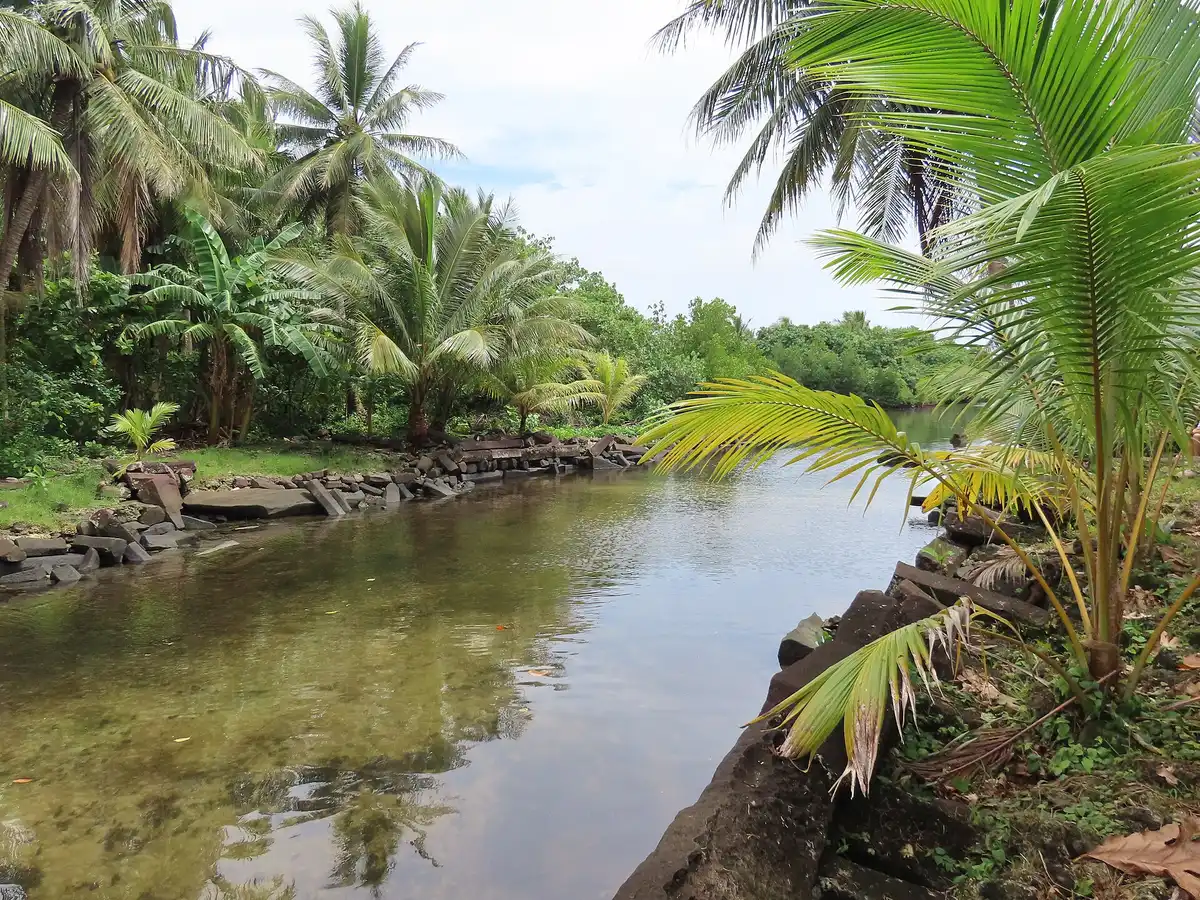
The water has its limit too. The 2013 sonar mapped the harbor except directly in front of Nan Mwoluhsei, where wind and waves stopped it, and the team wrote that its results "do not necessarily deny" a legendary city. Sefton's paper adds that "evidence for early settlement could lie undiscovered below present sea level." It means settlers, not lost cities. It is still a mainstream statement that the record of the Pacific is missing its bottom edge.
The Stones on the Lagoon Floor
A lidar flight in March 2019, reported by Douglas Comer and colleagues, found an irrigated cultivation system on Temwen Island, undated and comparable in labour to Nan Madol itself. UNESCO put the site on its List of World Heritage in Danger in 2016, and a 2026 decision kept it there. Traditional authority over the place stays with the Nahnmwarki of Madolenihmw. Pohnpei is still sinking, about a millimetre a year.
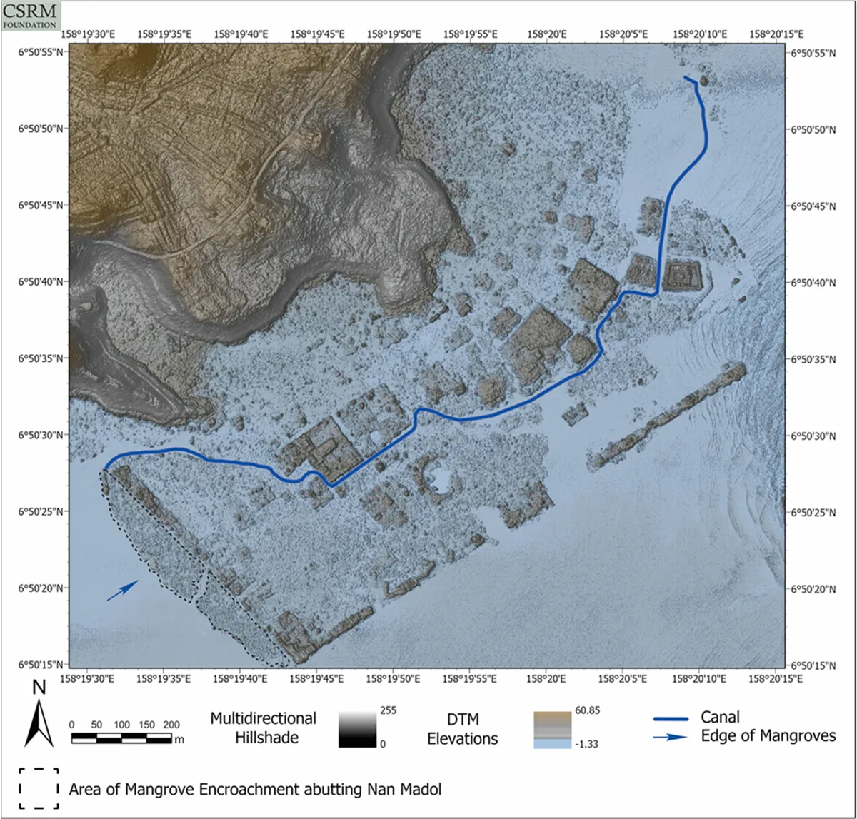
Which brings the question down to one patch of reef.
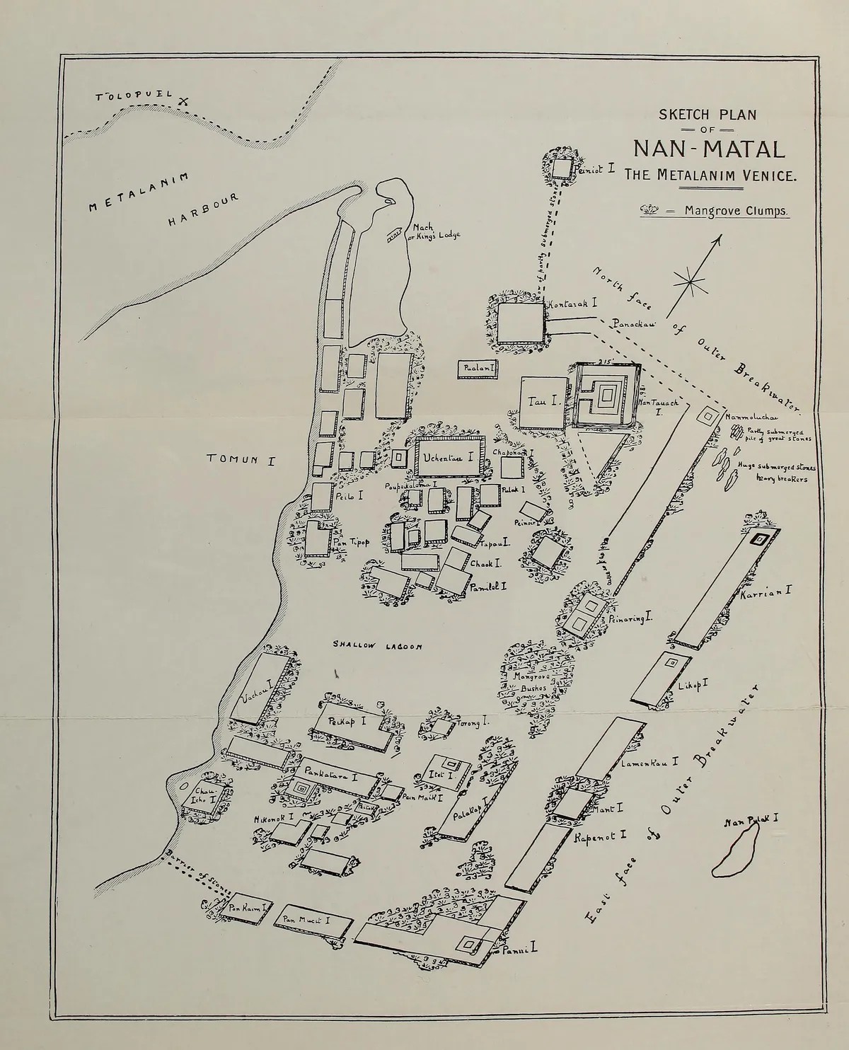
The sketch plan in Christian's book of 1899 marks it. Off the end of the sea wall sit two hand-lettered labels: "Partly submerged pile of great stones" and "Huge submerged stones, heavy breakers". The Oregon divers of 1988 and 1989 found basalt columns seaward of the wall and took them for lost, discarded or fallen building material. That is the stretch the sonar could not reach.
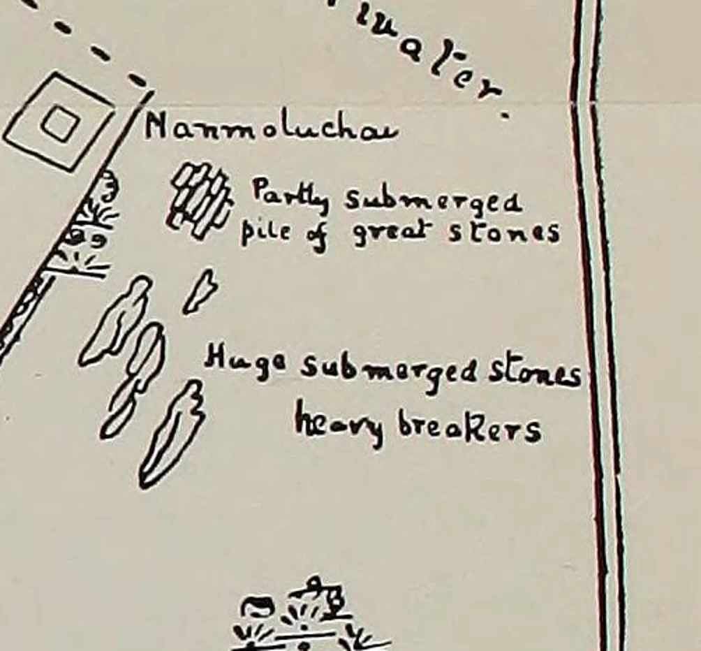
A pile of stone off the end of the wall. Lost, discarded or fallen.
A portable reader could give those stones the same chemical signature it gave the tomb, and a plan of where they lie might begin to draw a route. It could not show the vessel, and it could not date a city older than the coral.
A boatman in the lagoon had an account in 1895 that covers all of them. Black stone falls into salt water, and it grows.
Questions This Leaves You With
Is there anything you can actually do with this?
Nothing here changes how you live this week, and no date hangs over any of it. Anyone selling you a date for a lost age of this reef is selling something. The question that reaches beyond you is a civilisational one: what do people owe a place that is sinking a millimetre at a time, and to the people who hold it? That one is open, and it is being argued now in plain documents, in UNESCO decisions and in Pohnpei's own preservation law.
Does this sit against a religious account of the world?
It can cut either way. For some Pohnpeians, as Mauricio reported, the place is still not to be disturbed, and Ishimura's team argued that the sacred city under the harbor deserves protection as heritage whatever the divers find or fail to find. A person of faith can read that as respect, or as the point at which measurement should stop. Others hold that no sacred account fears a chemical reading of a stone. This site will not tell you which is right, and neither will the coral.
Does this change what a human life is?
Think of one person on a wall in the year 1100, passing up a log that weighs as much as eleven of them. That person never saw the place finished; the building ran for some twenty generations. You may feel that makes a life smaller, one pair of hands in five centuries. You may feel the opposite, that a single life can be load-bearing in something it will never see. Which of those came first when you read it?
What would change your mind, in either direction?
Name it now, before you are committed. Toward an older city: a basalt column at depth, bare of coral when cored, set on worked stone, with a date older than the corals. Or a coral inside a wall that came back thousands of years early, in a sample that could not have been reused. Toward the standard account: cores through the deep columns showing solid coral, as the Oregon divers found in one smaller column they raised, or a full-size column floated across the lagoon on a craft of the period and landed at the wall.
Where did the stones actually leave the island?
Here is the empty space. The chemistry has one plug on the far side of Pohnpei and a long list of possible sources. Pohnpeian tellers named the Not district in 1895. The record still has no quarry face, no shore where the stone was loaded and no craft. Hambruch's numbers run to 130, McCoy's survey put the islets on a GPS map, and lidar has seen through the forest, yet the last journey in the whole story has no line on any of those maps. Which way did the logs come in?
More photographs
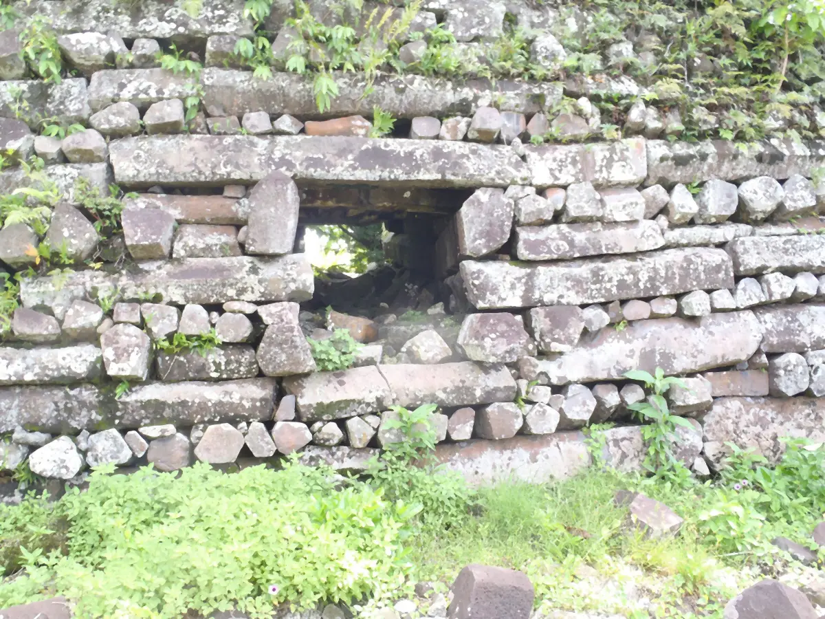
A low opening under a long basalt lintel at Nan Madol. Photo: Patrick Nunn, CC BY-SA 4.0 (creativecommons.org/licenses/by-sa/4.0), via Wikimedia Commons. Resized and smoothed. 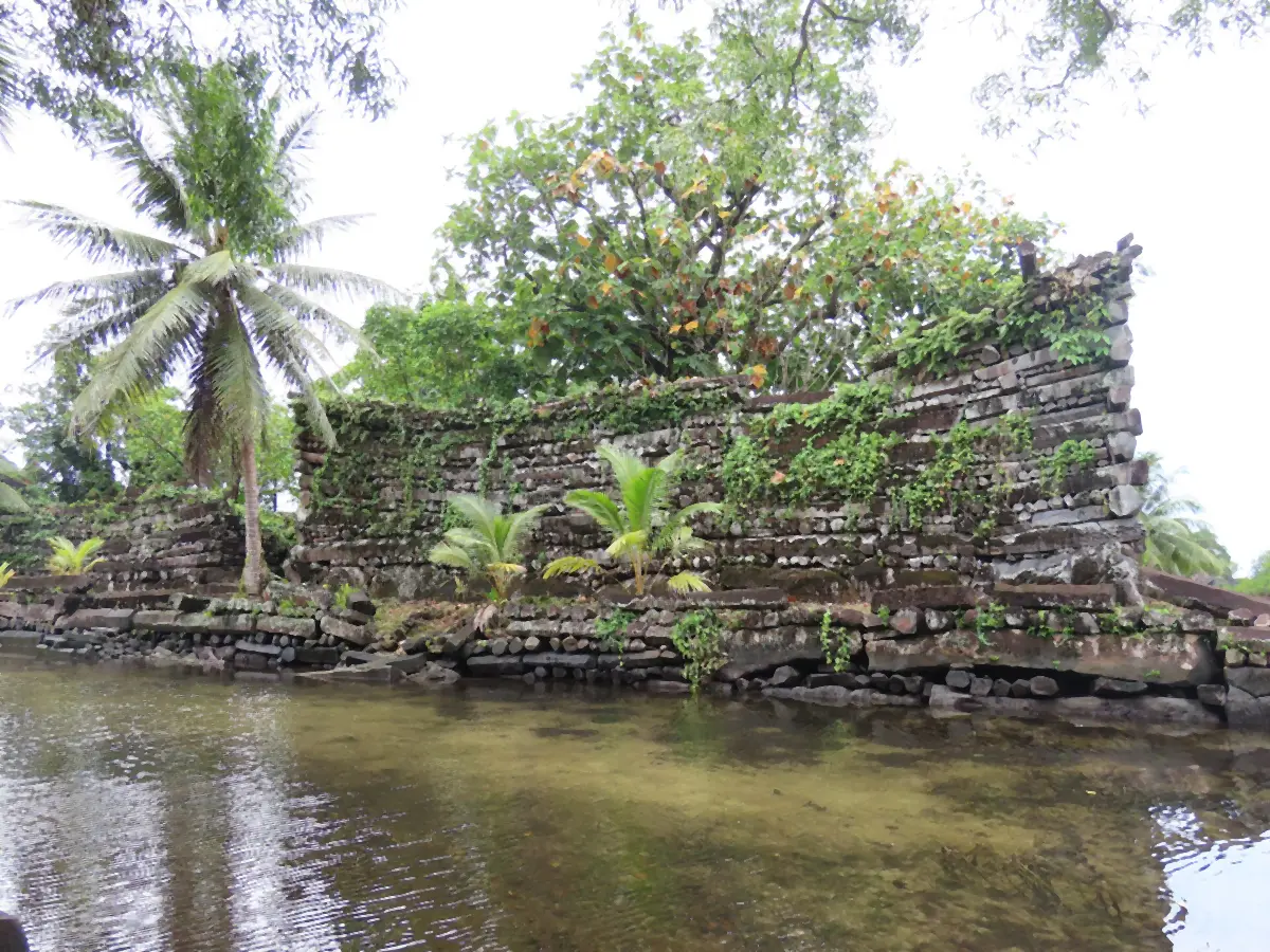
A wall with its corner rising, above a low stone edge and shallow water. Photo: Uhooep, CC BY-SA 4.0 (creativecommons.org/licenses/by-sa/4.0), via Wikimedia Commons. Resized and smoothed. 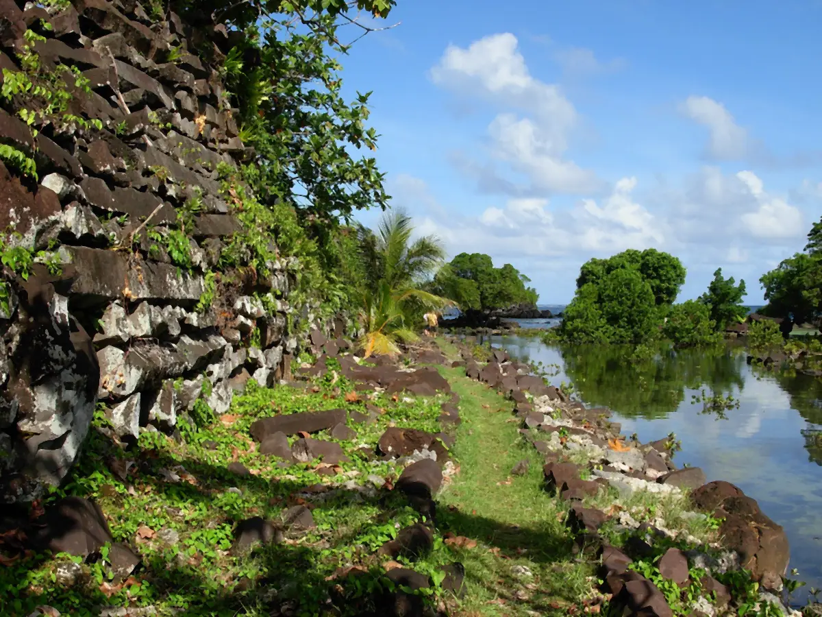
A wall of stacked basalt and the water beside it at Nan Madol. Photo: Lt Cdr Matthew Wingate, NOAA Corps, NOAA Photo Library smwd0030, CC BY 2.0 (creativecommons.org/licenses/by/2.0), via Wikimedia Commons. Resized and smoothed. 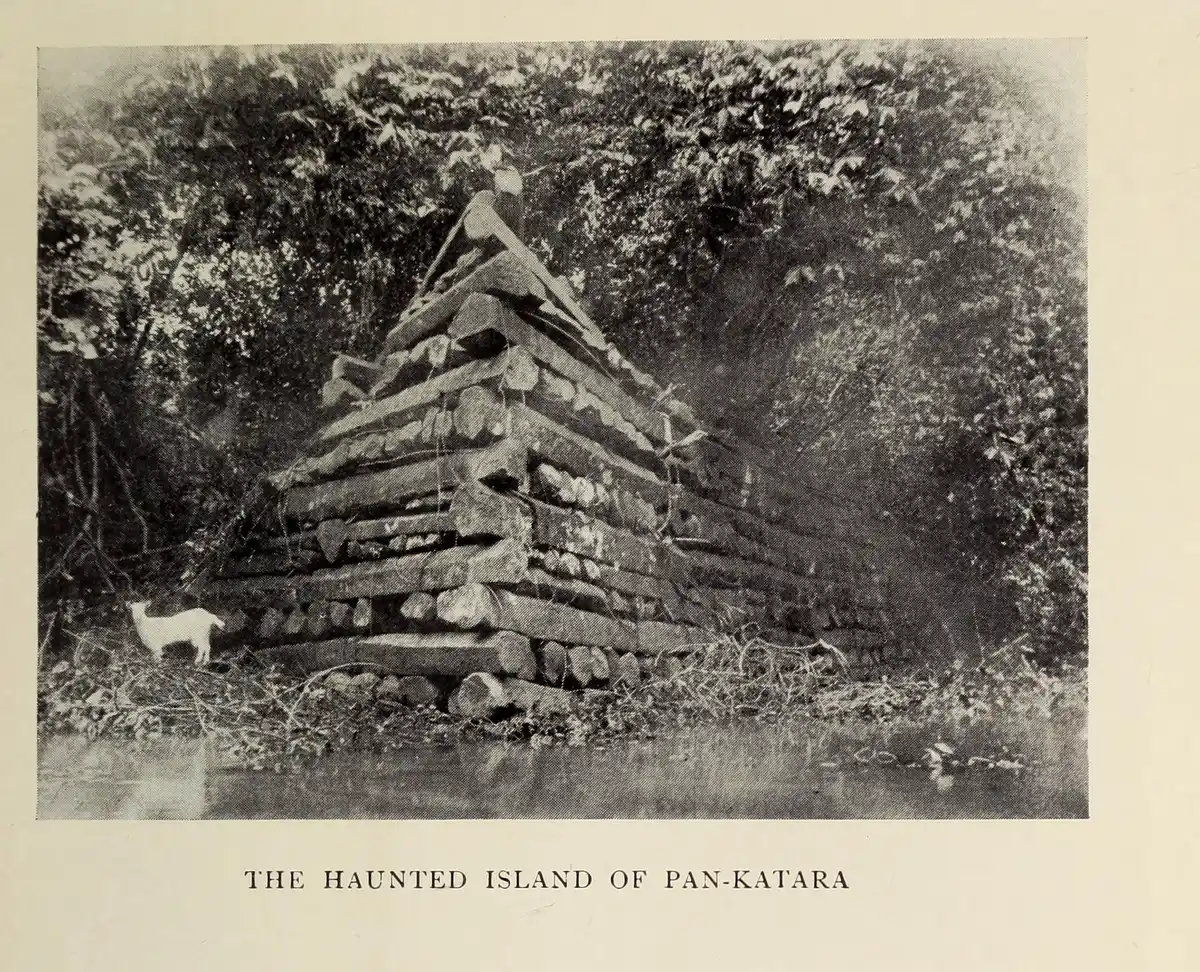
Pan-Katara, Pahn Kadira in Hanlon's spelling, in a plate from Christian's book of 1899, which titles it the Haunted Island. F. W. Christian, The Caroline Islands (London: Methuen, 1899), plate, photographed 1895, public domain, via Internet Archive. Cropped from the page. 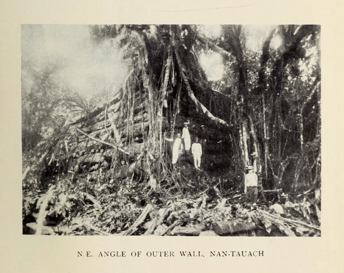
The outer wall of Nan Dauwas under roots, in a plate from Christian's book of 1899, titled N.E. angle of outer wall, Nan-Tauach. F. W. Christian, The Caroline Islands (London: Methuen, 1899), plate, photographed 1895, public domain, via Internet Archive. Cropped from the page and smoothed.
Select a photograph to see it full size, with its caption and credit.
Sources
- David Hanlon, Upon a Stone Altar: A History of the Island of Pohnpei to 1890, 1988 University of Hawaii Press; ScholarSpace catalogue record Study
- McCoy, Alderson, Hemi, Cheng, Edwards, Earliest direct evidence of monument building at Nan Madol, Quaternary Research 86, 2016 Quaternary Research (publisher record; read in the copy held by the FSM national archives) Primary record
- McCoy and Athens, Sourcing the Megalithic Stones of Nan Madol: an XRF Study, Journal of Pacific Archaeology 3(1), 2012 FSM Office of National Archives, Culture and Historic Preservation, Nan Madol collection Primary record
- McCoy, Alderson and Thompson, A new archaeological field survey of the site of Nan Madol, Pohnpei, Rapa Nui Journal 29(1), 2015 FSM Office of National Archives, Culture and Historic Preservation, Nan Madol collection Primary record
- Shen et al., Links between climatic histories and the rise and fall of a Pacific chiefdom, PNAS Nexus 3(10), 2024 PNAS Nexus, via PubMed Central Primary record
- Sefton et al., Implications of anomalous relative sea-level rise for the peopling of Remote Oceania, PNAS 119(52), 2022 PNAS, via PubMed Central Primary record
- Comer et al., Airborne LiDAR Reveals a Vast Archaeological Landscape at the Nan Madol World Heritage Site, Remote Sensing 11(18), 2019 Remote Sensing (MDPI) Primary record
- Joyce Bath and J. Stephen Athens, Prehistoric Social Complexity on Pohnpei, Micronesica Suppl. 2, 1990 Micronesica Study
- David Hanlon, The Pleasure of Speculation and Conjecture: Early Euro-American Visions of Nan Madol, Micronesica Suppl. 2, 1990 Micronesica Study
- Ishimura et al., Underwater Survey at the Ruins of Nan Madol, 2nd Asia-Pacific Regional Conference on Underwater Cultural Heritage, 2014 (Wayback copy) Museum of Underwater Archaeology Primary record
- William Ayres, Nan Madol, Madolenihmw, Pohnpei (Wayback copy) University of Oregon Study
- Nan Madol: Ceremonial Centre of Eastern Micronesia UNESCO World Heritage Centre Primary record
- Decision 48 COM 7A.25, Nan Madol, 2026 UNESCO World Heritage Committee Primary record
- F. W. Christian, The Caroline Islands: Travel in the Sea of the Little Lands, 1899 Methuen, London; Internet Archive (public domain) Primary record
- James Churchward, The Lost Continent of Mu, 1926, pp. 72-73 Internet Archive Primary record
- Rittlinger, Der masslose Ozean: Roman der Suedsee, List, Munich, 1954, catalogue record Deutsche Nationalbibliothek Primary record
- Justin Nobel, Land of the Flying Stones: a conversation with Rufino Mauricio, Archaeology 63(3), 2010 Archaeological Institute of America Primary record
- Jason Colavito, Are There Ancient Platinum Coffins off Nan Madol?, 2012 jasoncolavito.com Study
- Ponape: The City Beneath the Waves (gallery captions) Graham Hancock Primary record
- Experts say Ancient Apocalypse Netflix series is racist, untrue, 2022 ABC News (Australia) Study